The Map of Eastern Hemisphere is a fascinating gateway to exploring our world’s rich history and diverse geography. As I gaze upon this intricate map, I am reminded of the vastness and complexity of our planet.
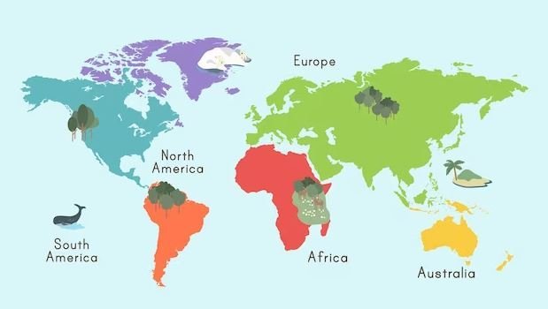
The Eastern Hemisphere, comprising Europe, Asia, Africa, and Australia, has centuries of human civilization and natural wonders waiting to be discovered within its borders.
Join me on this journey as we unlock the secrets of the map of the Eastern Hemisphere, delving into its geography, historical significance, and the endless possibilities it offers for exploration.
What is the Eastern Hemisphere?
The Eastern Hemisphere is one of the two hemispheres that make up the Earth – the other being the Western Hemisphere. It is divided by the Prime Meridian, which runs through Greenwich, United Kingdom, and separates the Eastern and Western Hemispheres.
The Eastern Hemisphere encompasses a vast expanse of land, stretching from the easternmost point of Asia to the western edge of Africa, including Europe and Australia.
Understanding the Geography of the Eastern Hemisphere
To truly appreciate the map of the Eastern Hemisphere, it is essential to understand its geography. This region is incredibly diverse, showcasing various landscapes, climate zones, and natural wonders.
From the snow-capped peaks of the Himalayas in Asia to the arid deserts of Africa, the Eastern Hemisphere boasts a tapestry of geographical features. In Europe, we encounter majestic mountain ranges, such as the Alps and the Pyrenees, interspersed with fertile plains and winding rivers.
Asia, the largest continent, is home to breathtaking landscapes, including the vast Siberian tundra, the lush forests of Southeast Asia, and the expansive Gobi Desert. Africa, known for its incredible biodiversity, presents us with dense rainforests, vast savannahs, and the mighty Sahara Desert.
Australia, often called the “land down under,” showcases unique geographical features such as the Great Barrier Reef and the vast Outback.
Historical Significance of the Map of Eastern Hemisphere
The map of Eastern Hemisphere holds immense historical significance, as it visually represents the interactions, conquests, and trade routes that have shaped our world. Throughout history, empires have risen and fallen, civilizations have flourished, and cultures have collided within the borders of the Eastern Hemisphere.
One cannot explore the historical significance of the Eastern Hemisphere without mentioning the Silk Road, the ancient network of trade routes connecting Asia, Europe, and Africa.
This intricate web of paths facilitated the exchange of goods, ideas, and knowledge, fostering cultural exchange and shaping the development of civilizations. The map of Eastern Hemisphere allows us to trace the routes of this legendary trade network’s routes and witness its impact on the world.
Exploring Countries in the Eastern Hemisphere
The Eastern Hemisphere is home to many countries, each with its unique culture, heritage, and contributions to the world. From the bustling streets of Tokyo in Japan to the vibrant markets of Marrakech in Morocco, the diversity of experiences in the Eastern Hemisphere is unparalleled.
In Asia, we encounter India’s vibrant colors and rich traditions, the technological marvels of South Korea, and the cultural wonders of China. With its magnificent architecture and storied history, Europe offers a journey through time, from the ancient ruins of Rome to the romantic canals of Venice.
Africa beckons with its wildlife safaris in Kenya, the ancient wonders of Egypt, and the vibrant rhythms of South Africa. Australia, a continent in itself, captivates us with its unique wildlife, stunning beaches, and the vibrant city life of Sydney.
Blank Map of the Eastern Hemisphere: Why it’s Useful
A blank map of the Eastern Hemisphere is a valuable tool for educational purposes and personal exploration. By starting with a blank canvas, we can challenge ourselves to learn and identify this vast region’s countries, capitals, and physical features. It allows us to test our knowledge and expand our understanding of the world.
Whether used in a classroom setting or for personal enrichment, a blank map of Eastern Hemisphere encourages active learning and fosters a deeper connection with the geography of our planet.
It provides a visual representation that aids in memorizing and comprehending the vast array of countries and their geographical locations.
Using an Outline Map of the Eastern Hemisphere for Educational Purposes
An outline map of the Eastern Hemisphere is an invaluable tool for educators and students. Providing a simplified representation of the region allows for a focused study of individual countries, physical features, and historical events.
Teachers can utilize an outline map of the Eastern Hemisphere to engage students in interactive lessons and activities. Students can label countries, rivers, and mountains, enhancing their understanding of geography and fostering critical thinking skills.
The outline map can also be used as a base for projects, presentations, and collaborative learning, encouraging students to explore and research different aspects of the Eastern Hemisphere.
The Physical Features of the Eastern Hemisphere
The Eastern Hemisphere boasts diverse physical features that add to its allure and intrigue. From towering mountain ranges to vast oceans, the geography of this region is a testament to the forces that have shaped our planet.
In Asia, we find the majestic Himalayas, home to the world’s highest peak, Mount Everest. These towering mountains provide a breathtaking backdrop and serve as a natural barrier, separating the Indian subcontinent from the rest of Asia.
The Ural Mountains in Russia mark the boundary between Europe and Asia, serving as a geographical and cultural divide.
Africa, the second-largest continent, is blessed with the Nile River, the longest river in the world, which has nourished civilizations for millennia. The continent also boasts the Great Rift Valley, a geological marvel that stretches over 6,000 kilometers, offering stunning landscapes and unique ecological diversity.
Navigating the Map of the Eastern Hemisphere: Tips and Tricks
Exploring the map of the Eastern Hemisphere can be an enriching experience, providing a deeper understanding of our world. Here are some tips and tricks to enhance your navigation skills:
Start with the basics: Begin by familiarizing yourself with the countries, capital cities, and significant physical features of the Eastern Hemisphere. This foundation will serve as a solid starting point for further exploration.
Use color coding: Assign different colors to different regions or continents to visually differentiate them on the map. This technique aids in memorization and helps develop a mental map of the Eastern Hemisphere.
Trace historical trade routes: Follow the paths of ancient trade routes, such as the Silk Road, to understand the historical significance of different regions and the connections between civilizations.
Study physical features: Identify and label significant mountain ranges, rivers, and oceans. Understanding the physical geography of the Eastern Hemisphere will provide a context for the distribution of cultures and civilizations.
Conclusion: Map of Eastern Hemisphere as a Gateway to Exploration
The map of the Eastern Hemisphere is not merely a collection of lines and colors but a gateway to exploring, understanding, and appreciating our world. By delving into its geography, historical significance, and the stories it tells, we can expand our horizons and develop a deeper connection to the diverse cultures and natural wonders within its borders.
So, let us embark on this journey together, armed with a blank map of the Eastern Hemisphere and an insatiable curiosity. Let us unlock its secrets, connecting the past with the present and paving the way for a future of exploration and discovery.